Guide to Faroe Islands: A 9 Day Itinerary
Visiting Faroe Islands, 9 day itinerary guide. Things to do and getting around Faroe Islands.
Contents
- Introduction: Tour in Faroe Island
- Getting Around the Faroe Islands: Tips on Tunnels and Ferries
- Day 1: Vagar Island – Mulafossur Waterfall and Lake Sorvagsvatn
- Day 2: Viðoy – Best Views
- Day 3: North Eysturoy
- Day 4: Mykines and South Stremoy – Puffin Watching
- Day 5: North Stremoy: Best Landmarks and Views
- Day 6: Kalsoy: the Kallur Lighthouse Hike
- Day 7: Tórshavn: Explore the Capital of Faroe Islands
- Day 8: Nólsoy – Another Scenic Lighthouse Hike
- 9 Day Itinerary Conclusion
Introduction: Tour in Faroe Island
We visited Faroe Islands for 9 days and I honestly believe that is enough time to visit this autonomous territory in the North Atlantic. My visit was in the Summer season in August but keep in mind that this is peak season. After looking for information on the Internet I realised that the best way of getting around the islands is by car, although we needed to take some ferries to visit some other islands.
In total, we visited 8 islands (3 islands by ferry or boat). If you get your accommodation in the Capital Tórshavn you can drive everyday to any of the connected islands by tunnel or bridges, the maximum distance will be 1 hour and a half driving.
Faroe Islands is one of the most remote regions in Europe with only fifty thousand inhabitants. These Volcanic islands are pure nature and one of the most peaceful places I’ve ever been.
Let me share our travels in Faroe Islands, things to do and some travel tips for this region.
Getting Around the Faroe Islands: Tips on Tunnels and Ferries
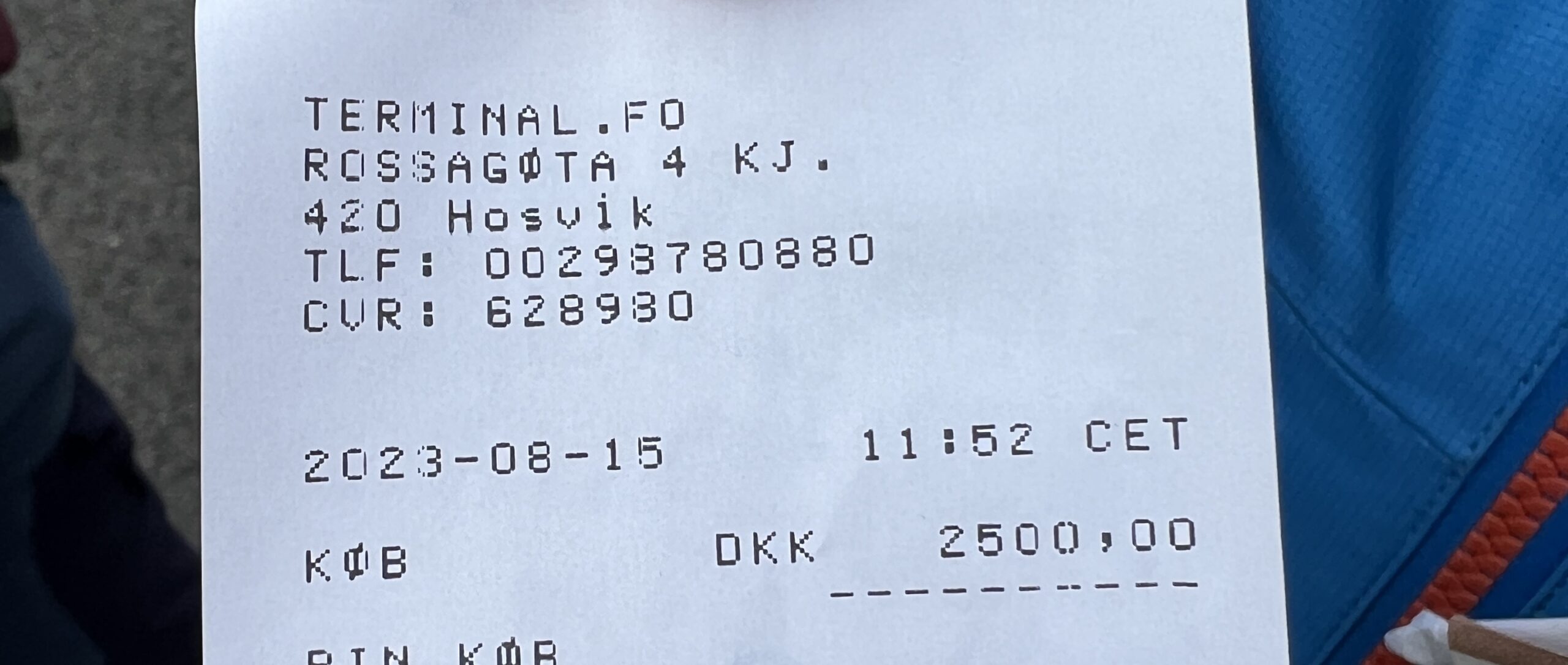
Moving around the Faroe Islands is made possible through sub-sea tunnels and bridges. But remember, using the tunnels means paying a fee, which ranges from 100 to 175 DKK (around 13.50/23.50 EUR to 14.50/25.00 USD). If you’re renting a car, the rental company usually provides a pass for these tunnels if you need it. By the end of 2023, a new sub-sea tunnel, Sandoyartunnilin, will open to connect Sandoy the South Island by car. UPDATE 2024: The Sandoyartunnilin tunnel opened on 21st December 2023 and became the fourth underwater tunnel in the Faroe Islands.
When we visited Faroe islands, I chose to rent a car from a local company, finding it to be a budget-friendly option. In my opinion, it’s the best way to move around the Faroe Islands. If you plan your travel route beforehand, you’ll likely only need to pay for the tunnel tolls a few times.
During my journey, we visited three islands that are reachable only by ferry: Mykines, Kalsoy, and Nolsoy. For these islands, you won’t need a car. Just find a spot to park your car at the harbour and hop onto the ferry. I’ll explain in more detail below how you can visit these three islands and whether it’s worth doing.
In my view, renting a car in the Faroe Islands is a smart choice as it gives you the freedom to discover the islands on your own terms. While there are buses and ferries that can take you to the main spots, they come with fixed schedules that might limit your exploration options.
Day 1: Vagar Island – Mulafossur Waterfall and Lake Sorvagsvatn
Highlights:
- Gasadalur
- Múlafossur Waterfall
- Lake Sørvágsvatn
- Trælanípa cliff
- Bøsdalafossur waterfall

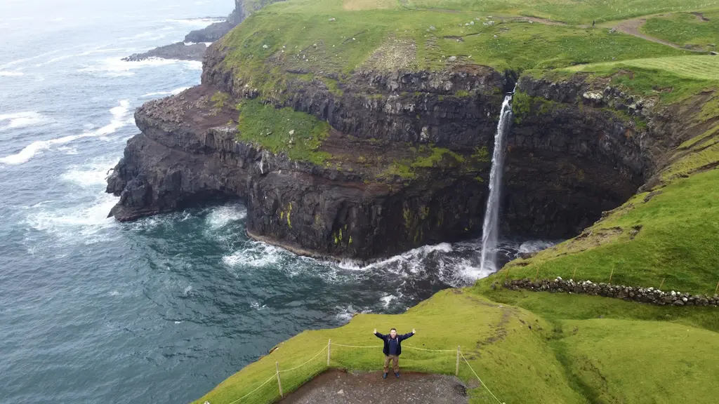
In our first day, we visited Vagar Island. You should try to schedule a sunny day for visiting Vagar, it will be stunning. We drove to Gasadalur in the morning to explore my favourite Waterfall in the Islands, Múlafossur Waterfall. You will need to walk 5 minutes by the trail to see the waterfall. This has become a very popular spot for Photographers. After visiting the waterfall, just walk to the Sunset Viewpoint near Gasadalur.
Then, we took the car to Sørvágur, in this little town you can walk on the beach and visit the typical church that you will see in other towns and you can also find a cafe (« Cafe Pollastova ») before continuing your travel.
From this point, we drove further south and explored one of the highlights of Faroe islands, the Lake Above the Ocean (Lake Sørvágsvatn). You firstly need to reach the trailhead to Trælanípa cliff. There is a short hike of around 6 km. (go and back distance), and it will take around 2.5 hours, no worries, it is an easy hike. Unfortunately, there is a fee for hiking of 200 DKK (26 EUR/30 USD). In this case it is worthy in my opinion.

If you hike to the top of the Trælanípa cliff (142 metres high), you will see the optical illusion of the lake above the Ocean. From there, you can walk to the Bøsdalafossur waterfall at the end of Lake Sørvágsvatn. Another marvellous view of the cliffs, waterfall and lake.
Day 2: Viðoy – Best Views
- Highlights: Hike to Villingardalsfjall Peak on Vidoy Island

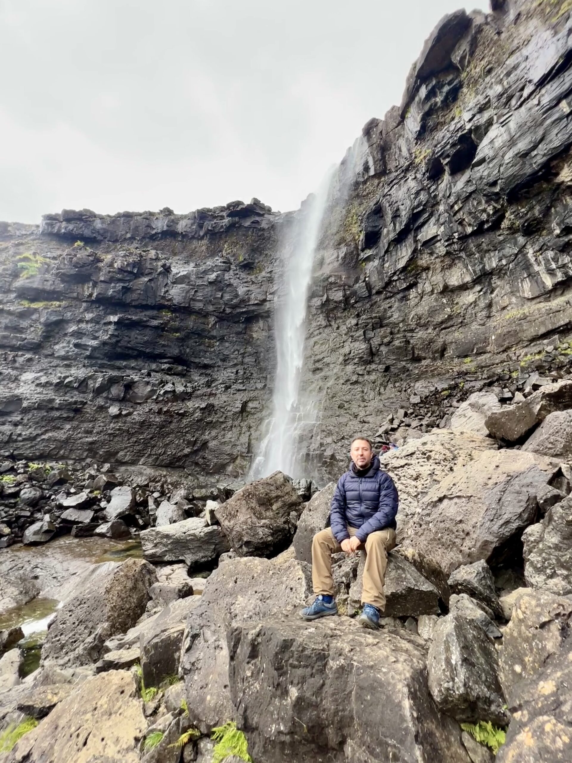
On my second day, we set out for one of the northernmost points accessible by car, Viðoy Island. The journey to Viðoy involves crossing two sub-sea tunnels and several mountain tunnels and it can take 1 hour and a half driving. Along the way, you can make a pit stop in Klaksvík to purchase snacks and water for the hike. Keep in mind that Viðoy Island itself lacks cafes, gas stations, or shops.
This is one of the most off-the-beaten-path hikes in Faroe Islands. It’s a challenging trek that can take around 4 to 5 hours. In my case, it took even longer due to an unfortunate incident: during my descent down the mountain, I slipped and twisted my ankle, making the last 1.5 kilometres a painful experience.
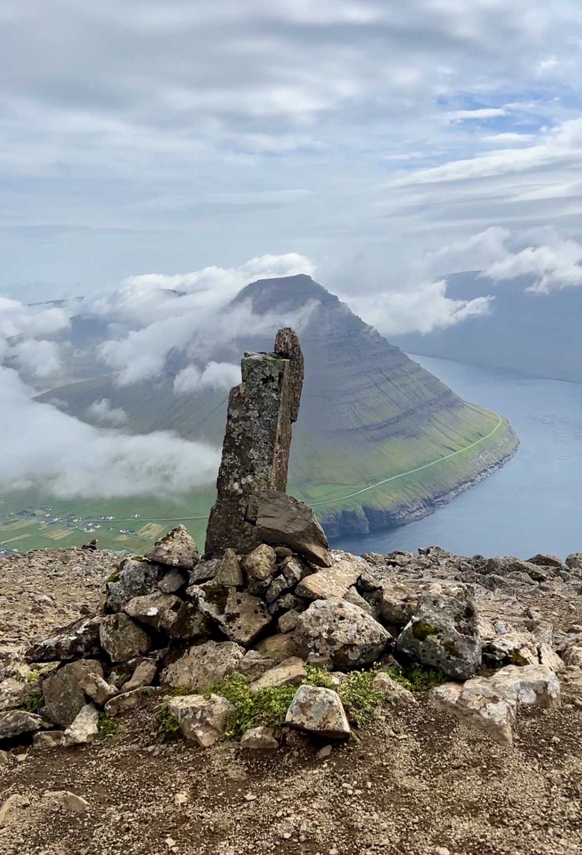
Once you reach the town of Viðareiði, head towards the northern trail, which leads to the trailhead for ascending Villingardalsfjall Peak. This Peak is the third highest mountain in the Faroes with an elevation of 841 metres.
This hike crosses a private property, therefore there is a fee of 200 DKK. However, no one is stationed at the entrance to collect this fee. Instead, you’re requested to deposit 200 DKK per person in the mailbox located by the gate at the trailhead.
Please keep in mind that the elevation gain will be 829 metres in approximately 3 kilometres. And the total length of the trek varies between 4 to 6 kilometres, depending on your chosen endpoint at the summit.
The trail is fairly difficult, as the terrain becomes progressively rocky on the ascent. The path is marked with blue plastic tubes that stick out of the ground. As you reach the summit, you can choose to continue following the blue markers to the peak or opt for the marked cairns (piles of stones) leading towards the steep Enniberg cliff.
However, the most difficult part of the trek is going down the mountain as there are many loose stones and it is quite slippery. It is also IMPORTANT to check the weather forecast beforehand and if the conditions get worse just turn back or refrain from starting the ascent to avoid getting lost.
Unfortunately on my way down, I personally experienced how slippery the terrain was and I fell down twisting my ankle. Luckily, I was accompanied by fellow travellers who assisted me down the mountain despite the pain. Please, if you go alone, consider walking with other groups or hire a guide.
After completing the hike, take some time to explore the viewpoint near Viðareiði Church. Then, make your way back to Klaksvík for some well-deserved rest and relaxation at a local café.
Day 3: North Eysturoy
Highlights:
- Gjógv village
- Puffins
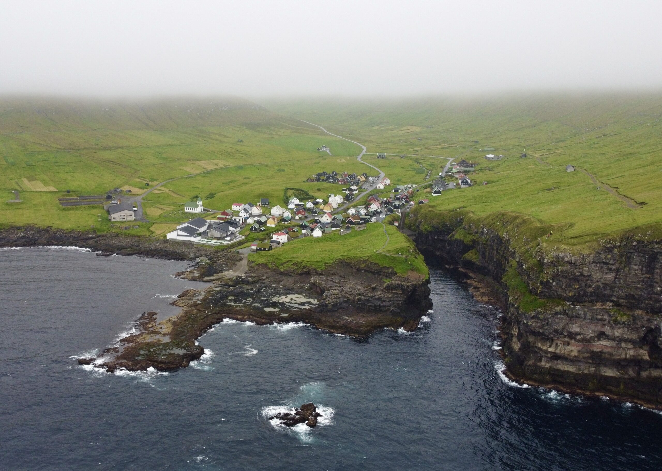
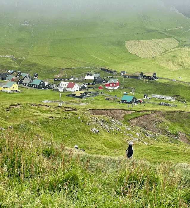
On this day, we headed to a small village called Gjógv on the northern part of Eysturoy Island. It took us just about an hour to drive there from Tórshavn, and along the way, we enjoyed some beautiful views.
Though Gjógv is a small village, it has its own special charm. The village has a natural harbour, and you can take a walk to a spot called Crown Princess Mary’s bench. You can also find a trailhead for a walk around the town that leads to some amazing views from the cliffs.
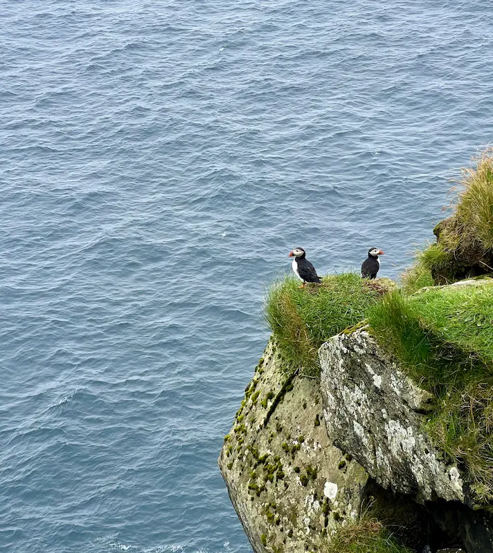
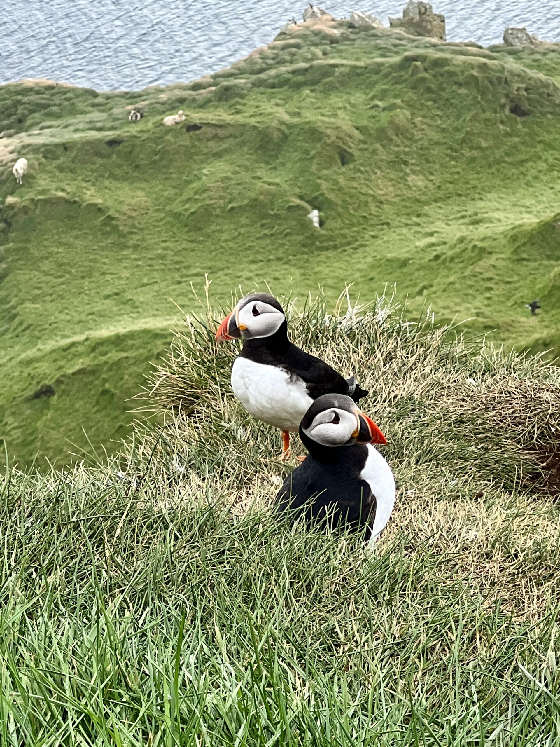
During our walk along the cliffs, we got a wonderful surprise – we spotted puffins! These cute birds hang out in the deep gorge of the village. The best time to see them is from May to August. What’s great is that you don’t have to pay anything to watch them here, unlike the expensive puffin-watching tours in Mykines. (I will talk about this below).
We also had lunch near the local café. One thing to keep in mind is that finding cafes or restaurants can be a bit tough on these islands, so it’s smart to bring some food for lunch with you and it is also a cheaper option.
Later in the day, the weather conditions worsened – fog covered the whole northern area of Eysturoy. Unfortunately, we couldn’t visit two of the highlights that we planned to see: Risin og Kellingin viewpoint and Eiði Town. Here’s a useful tip for travelling in the Faroe Islands – it’s a good idea to have a backup plan because the weather can change quickly. But the good news is that you can usually find another island to explore with better weather, and it’s usually just an hour away.
So, in our case, we decided to go back to Tórshavn, the main city. We spent the evening by the harbour and checked out a famous local pub called Mikkeller. But I’ll tell you more about Tórshavn in detail a bit later.
Day 4: Mykines and South Stremoy – Puffin Watching
Highlights:
- Mykines – Puffins
- Kirkjubøur
Well, let’s discuss visiting Mykines. I want to be upfront and say that, in my opinion, this island is overrated. Before I went, I read a lot about Mykines Island and its reputation for puffin sightings and hiking to the lighthouse. Therefore, it was on our list of places to visit in the Faroe Islands. However, after my experience, I will address the question below:
Is Visiting Mykines really worth it? An Honest Review
Based on my experience, I’d say: No, it’s not worth it—unless you’re fascinated by puffins and birds (though there are cheaper or free places to see these birds), or you have extra time and money to spare.
How to get to Mykines in Faroe Islands: Transport tips
Let me elaborate the reason I believe this place is overrated: first you need to book in advance the Ferry or Mykines Shuttle Boat to the island (a cost of 700 DKK, around 80 EUR or 100 USD per person for a 20-minute ride to the island, including the return trip).
Once you’ve arrived on the island (and to be fair, part of this is my own fault for not researching enough beforehand), at the entrance of the village, there’s a person collecting a fee of 500 DKK (about 64 EUR or 72 USD) solely for the 20-minute hike to see the puffin birds. And according to the locals you’re not permitted to trek on your own without a guide. So, they tell you that if you’re not interested in the hike, your only option is to stay in the village, where there’s a cafe (which, in my opinion, is also overpriced).
On top of this, the trail to the lighthouse is currently closed due to landslides in the area, making it unsafe to trek there.
Therefore, from my experience, it is not worth paying around 144 EUR or 172 USD for just visiting the island and spending a maximum of 1 hour trekking around the small village. Especially when you consider that the day before, we saw puffins for free on the other side of the Faroe Islands.
On a positive side, if you’re truly keen on seeing birds, particularly puffins, in this island you can see one of the largest puffin and bird nesting populations. It’s an incredible sight. To catch the boat to Mykines, make your way to Sorvagur Port. The boat ride to the island is quite short, lasting around 20-30 minutes. Make sure that you take the Ferry to Mykines instead of the expensive shuttle boat. However, keep in mind that the weather might impact the boats, potentially leading to cancellations.
Explore Kirkjubøur: Streymoy’s Historic Town
Mykines only took half a day so we had time to explore the south of Stremoy, particularly the village of Kirkjubour. On our way to the southernmost village of Streymoy, we passed through Sydradalur and Velbastadur villages simply to see the scenery and landscapes. Alternatively, you can also head straight to Kirkjubour, one of the Faroe Islands’ most historically significant sites.
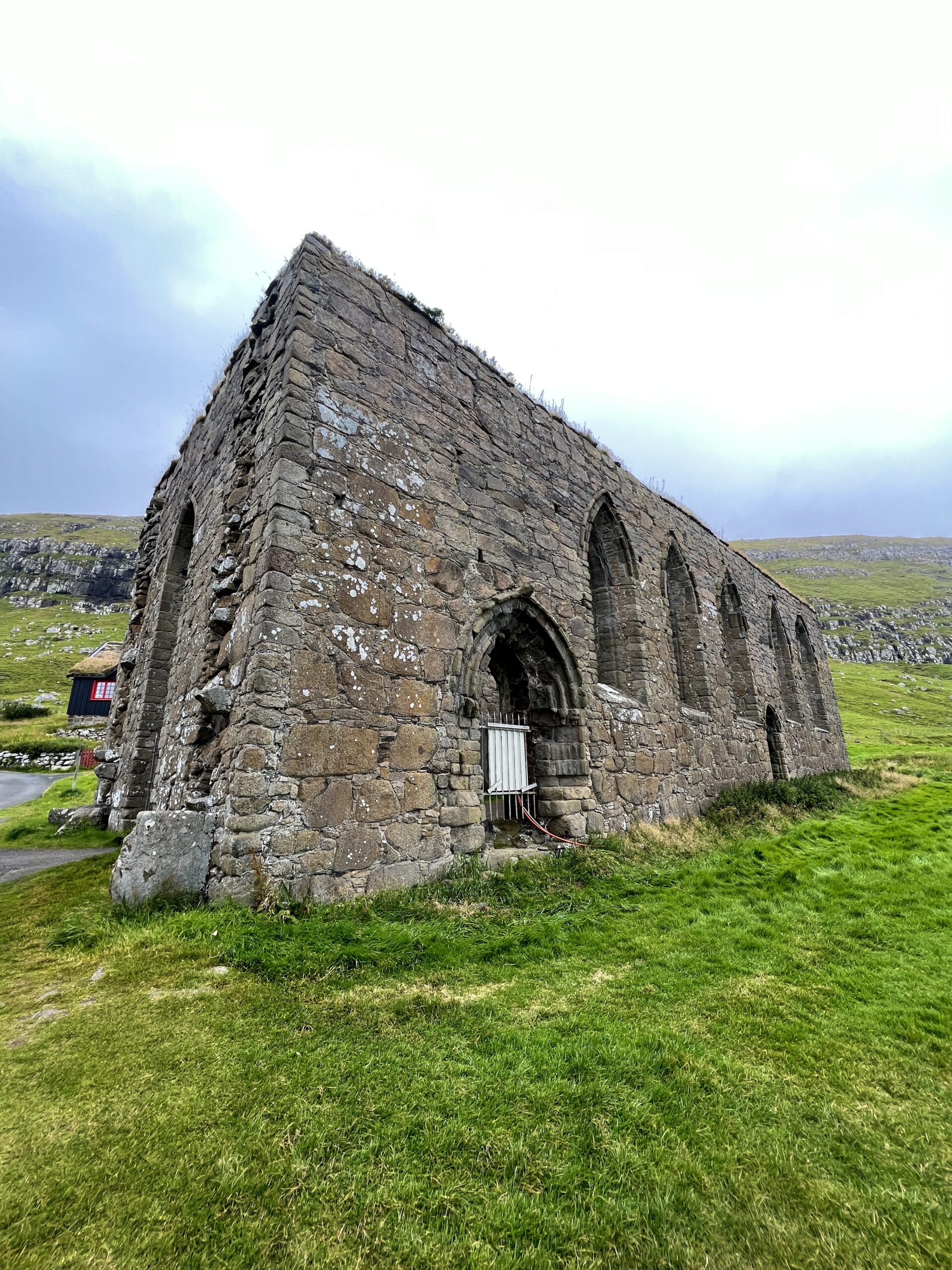
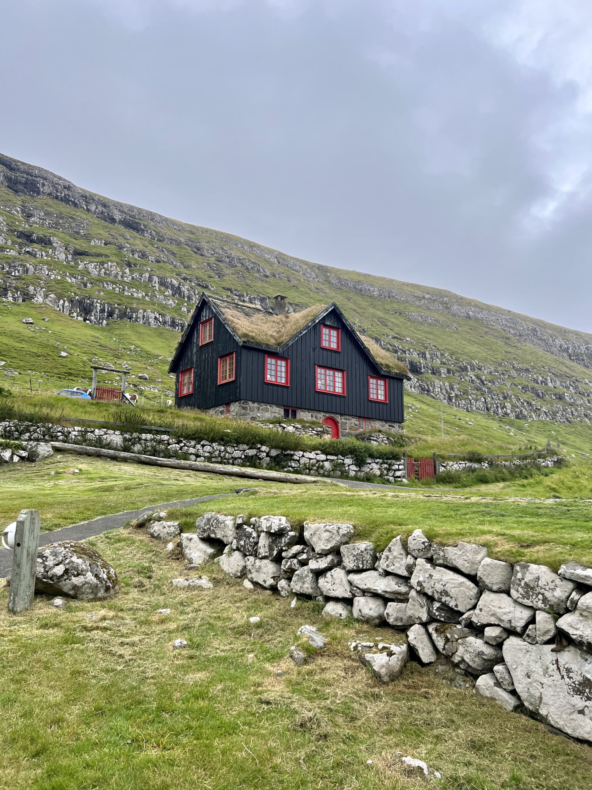
Within the village of Kirkjubour, you’ll discover the remnants of the Magnus Cathedral, believed to date back to around 1300, and Saint Olav’s Church, which still serves as a place of worship and dates all the way back to the 12th century. We really liked this village due to the charming traditional houses, topped with roofs covered in grass. A famous example of this is Kirkjubøargarður, recognized as the world’s oldest inhabited wooden house, from the 11th century.
In the cultural centre of the village you can learn that Kirkjubøur once occupied a larger area, but a devastating storm in the 16th century claimed around 50 homes and resulted in parts of the village being claimed by the sea.
Day 5: North Stremoy: Best Landmarks and Views
Highlights:
- Fossa Waterfall
- Tjørnuvík
- The cliffs west of Vestmanna Vestmanna
- Saksun
The northern part of Stremoy is a treasure of natural wonders – waterfalls, lakes, black beaches, and towering cliffs. Our day began with a drive to Fossá Waterfall, the tallest waterfall in the Faroe Islands at 140 metres. The waterfall is located alongside the main road leading to Tjørnuvík. You can park your car just after the bridge. The sight of the white water against the dark basaltic landscape creates a striking contrast, making it a perfect spot for photographers. After heavy rain or a big storm, the waterfall’s stream becomes an astonishing view.
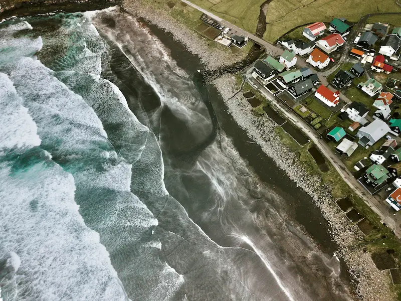
From the Fossa, we headed to the charming village of Tjørnuvík. Getting there requires driving a single-lane road that accommodates traffic in both directions (a recently installed traffic light helps manage traffic flow). If you can visit only one village in the Faroe Islands, make it this one. The views are breathtaking and there is a nice black sand beach in front of the village that is quite popular with surfers.Additionally, the iconic Risin og Kellingin sea stacks, often referred to as the Giant and the Witch, are visible from here. While there’s a hiking route from Tjørnuvík to Saksun, we opted for the car route on this occasion.
Our next stop was Vestmanna Port, where we embarked on a boat tour of the Vestmanna Sea Cliffs. This roughly 2-hour sail along the coast took us through narrow grottos, surrounded by colossal 700-metre cliffs. The clear water in this area allows glimpses of the sea floor in some spots. This is another opportunity to spot birds, although having binoculars would be better. The boat tour costs 400 DKK (around 53 EUR/58 USD). While I found it a bit pricey, if time and budget allow, it’s a worthwhile adventure.

At the end of the day, we visited Saksun, one of my favourite places in the Faroe Islands. The drive to this village is an experience in itself, with the road being another single-lane. Traffic might slow you down as you have to stop many times due to oncoming cars, but the panoramic views make it all worthwhile and I really like the drive with the light of the evening.

Once you reach Saksun, you can visit the church and the museum/cafe or head to Sanksun’s lagoon and beach, the most interesting part of this area. Along the way to the beach, you will have amazing views of the Pollurin Waterfall and a lagoon. This lagoon used to be a natural harbour until it was blocked by sand from a big storm. However, remember that the black beach at Saksun is only accessible during low tide; be vigilant as the tide rises. Interestingly, a hiking fee of 75 DKK (about 10 EUR/11 USD) is requested here. You can pay by credit card at the valley gate, although no one monitors payment. On our visit to Saksun Beach, we tried to fly our drone, unfortunately the wind was so strong there that we got the drone lost in one of the cliffs, so be cautious about flying drones here.
Day 6: Kalsoy: the Kallur Lighthouse Hike
Highlights
- Kallur Lighthouse
- Seal Woman Sculpture.

Visiting Kalsoy is an adventure that involves taking a ferry, and I highly recommend leaving your car behind. Ferry spots for cars are limited (only 12), and there’s a chance your car won’t find a spot on the return ferry due to priority given to residents. The good news is, you won’t need a car on Kalsoy at all.
Drive to Klaksvík port and simply board the ferry (40 DKK, approximately 5.30 EUR / 5.80 USD). For foot passengers, there’s always space. Leave your car at the port. The ferry ride to Kalsoy Island takes about 20 minutes. Upon arrival, a bus awaits the ferry passengers, ready to take you to the northern village of Trøllanes.
From Trøllanes, you can go hiking to the Kallur Lighthouse, – a walk that takes a maximum of 2 hours round trip. There you can stop for admiring the views, visiting the James Bond Tombstone, a spot featured in the movie “No Time to Die” (though the Faroe Islands may not be immediately recognizable in the film). I have to point out that this hike also crosses private property and they will make you pay 200 DKK for trekking to the lighthouse 27 EUR/29 USD). In my opinion, I found this fee rather excessive, a total scam, but it is the only activity that you can do in Kalsoy.

Upon returning to Trøllanes, catch the bus to the second village on Kalsoy, Mikladalur. Here, you can explore the Seal Woman Sculpture and take a break at a cosy cafe/bar before heading back to the port for the ferry ride to Klaksvík.
With part of the afternoon and evening still ahead of us, we decided to revisit the Saksun Village and then spent the rest of the evening in the capital Tórshavn.
Day 7: Tórshavn: Explore the Capital of Faroe Islands
Highlights:
- Pilot whales
- Tórshavn
On this day, I will talk about the capital city, Tórshavn (although we ended up walking around the town almost every evening), and some of the surrounding places you can visit from here. We chose this day to relax after an entire week of trekking and visiting other islands. In the morning, we visited the town of Sandavágur on Vágar Island, near the airport. We stumbled upon a delightful café/restaurant called Fiskastykkið at the end of the town, which specialises in fish dishes.
Later, we spent the day exploring the capital of the Faroe Islands, Tórshavn. This city is considered the smallest capital in the world and is more like a town. (Keep in mind that the entire Faroe Islands has a population of around 50,000 inhabitants.) Our favourite spot in the town was Mikkellers’ Bar, where you can enjoy a wide range of beers; one of our favourites was the cranberry beer. It’s a cosy bar that both tourists and locals frequent in the evenings. After a day of hiking, you can just chill there; they even have board games to keep you entertained.
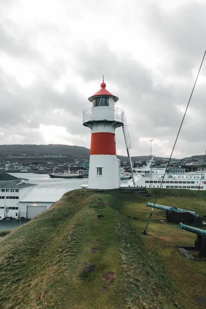
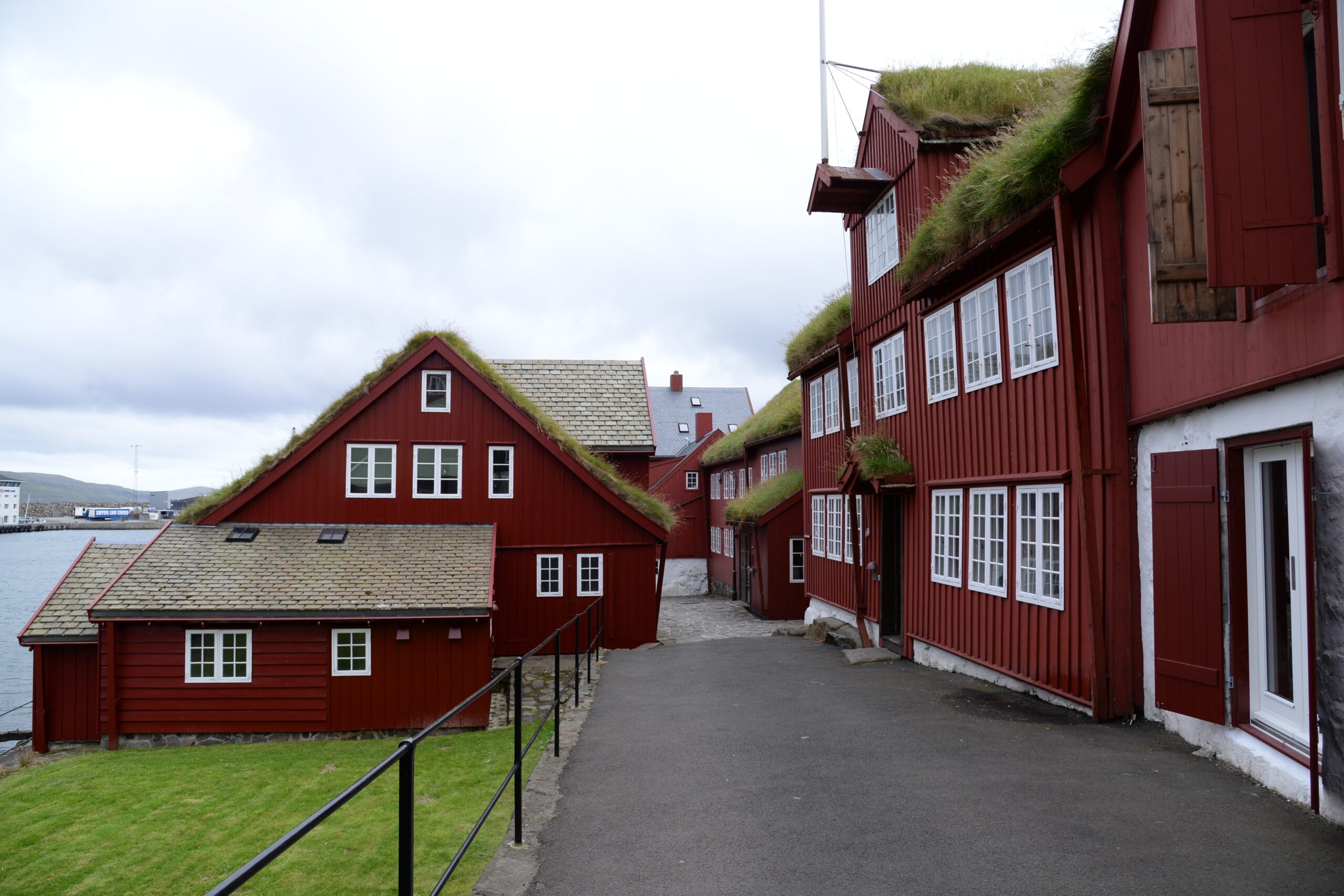
While in the town, you can also visit the lighthouse and the Skansin fort, a historical site built in 1580 and later used in WWII by the British army that occupied the islands temporarily, you’ll find large guns from the British occupation. Aside from that, wandering around the centre amidst the charming wooden houses is a must. It’s interesting to note that the houses are made from wood, even though there are no trees on these islands.
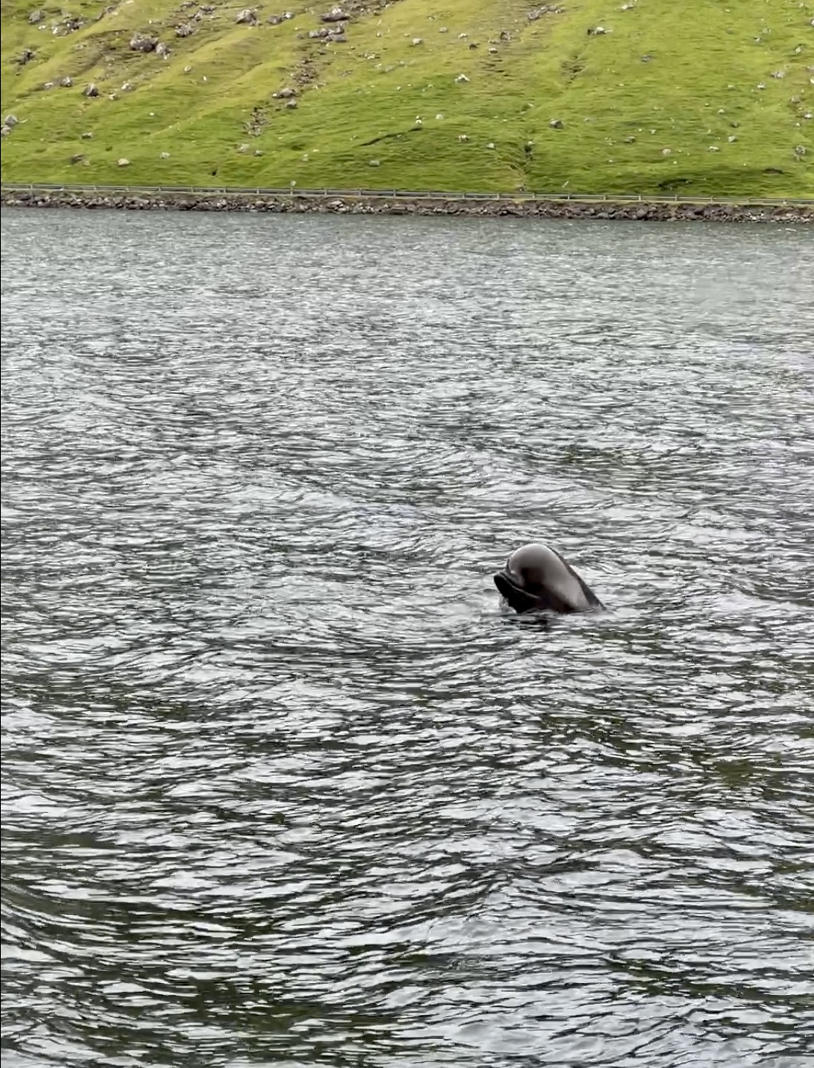
Now, let’s talk about a spot outside of the town that you’ll come across every day if you’re staying in Tórshavn: the Pilot Whales’ sighting area. As you drive north on road 50, you’ll notice a place where many cars pull over (try to find a spot where you don’t block traffic). Park your car there, and with a bit of patience, you’ll be able to see the pilot whales, especially during the summer months. During my travels, we spotted three whales every day as we passed by that location. If you’re willing to wait patiently, you’ll get to witness them playfully jumping out of the water.
Tórshavn has a few museums, but we didn’t visit any of them as I felt that the true essence of this region lies outside. The town also boasts several excellent restaurants, but keep in mind that they can be pricey. We tried the Katrina Christiansen restaurant for dinner, and the menu was delicious, but be prepared to pay around 70 EUR/75 USD per person.
Day 8: Nólsoy – Another Scenic Lighthouse Hike
Highlights:
- Hiking to Nolsoy lighthouse

On this day, we caught the 12:30pm ferry to Nolsoy, an island we had planned to trek up to the lighthouse located on the opposite end of the island. Despite the rather foggy conditions, we decided to proceed with our plan. It’s worth noting that you don’t need to bring your car along for this ferry ride, as Nolsoy has minimal roads.
We packed some food for lunch and once we arrived at the island we started hiking towards the lighthouse. However, keep in mind that the trail is marked only by small blue wooden sticks (which are sometimes barely visible) and cairns made of stacked stones. On our particular day, the fog grew quite dense and it was difficult to orient ourselves. It’s crucial to ensure you can spot the next cairn or blue marker before continuing your hike.

After about 2 hours of walking, our efforts were rewarded with breathtaking views. Just walk beyond the last two houses and you will reach the lighthouse. There, the wind was fierce, and the panoramic views were truly astounding. We had our lunch near the lighthouse and then we initiated the way back. While the fog was leaving, a heavy rain started at the same time. We needed to be extra careful as there are parts of the trail with rocks that can be slippery. The terrain was also quite soaked, so sturdy waterproof shoes are a must. Completing the entire trek took around 4-5 hours.
As the rain escalated into a storm, we found ourselves soaked upon returning to the village. We managed to find the local Pub/Cafe, Maggies’ Café, and we could warm up and relax until the ferry departed to the capital again. We arrived in the evening to the main island and you can have one more beer in the famous local pub, Mikkelers. This was our last day of our trip, and even though we got soaked due to the rain we really enjoyed the last hike in Faroe islands. I can confidently say that Nolsoy island and its hike was also one of my favourite experiences on my visit to Faroe Islands.
9 Day Itinerary Conclusion

I consider Faroe Islands as one of Europe’s most remote and nature-rich regions that is worth visiting if you like nature. We spent 9 days on the Faroe Islands and I think that is enough to have an idea about this autonomous territory. However, we did miss visiting the southern islands of Sandoy and Suduroy, as well as spending more time hiking in North Eysturoy. Fortunately, with the new sub-sea tunnel opening in December 2023, visiting Sandoy should become more accessible by car.
Therefore, my recommendation is to plan a 7 to 9 days trip to enjoy this country, and I would advise against a trip lasting 5 days or less. Due to the unpredictable weather conditions, it is good to have time that allows you to reschedule plans or treks during a week-long visit. Furthermore, I strongly recommend renting a flat instead of a hotel due to the expensive prices in the islands. Having a flat will allow you more flexibility for lunches and dinners.